Over 10 years we help companies reach their financial and branding goals. Engitech is a values-driven technology agency dedicated.

Gallery

Contacts

411 University St, Seattle, USA

engitech@oceanthemes.net

+1 -800-456-478-23

GIS APPLICATION DEVELOPMENT

BrainFuel with its proven expertise has assisted big brands to develop dynamic and robust GIS web applications and open source GIS mapping software.

Going Beyond Geographical Boundaries

Utilising the power of Geographic Information System (GIS), BrainFuel has set itself apart providing applications for large enterprises and government organisations, putting the best use our skills in designing, implementing and integrating GIS applications. Our GIS solutions are suitable for everyone, whether for a small business or a multinational corporation. Our expertise in working on GIS ranges from small businesses to government institutions.

BrainFuel’s GIS application development services combine navigation tools, imagery, quick searches and zoom in options among others contributing to operational ease. Maps and locations can be saved and customised to generate the desired results using our GIS applications.

Does your Organization have Golang Needs?

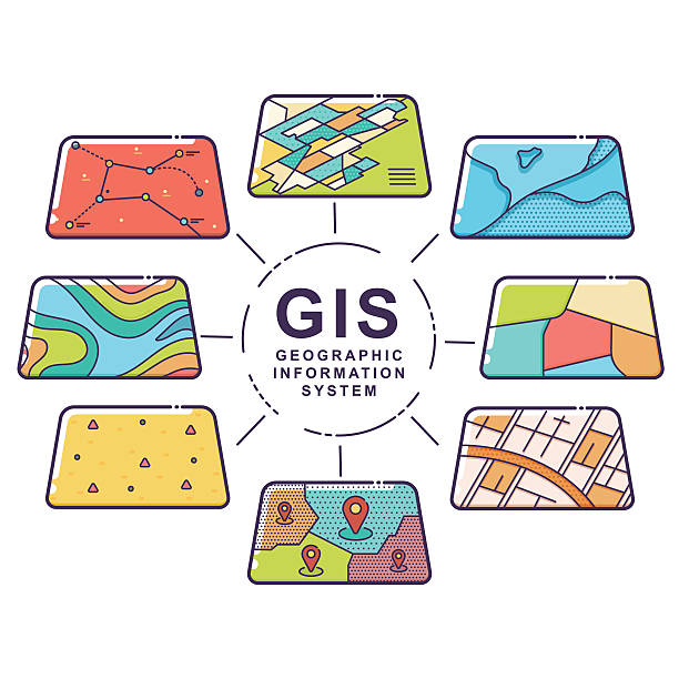
GIS Consulting & Application Development

BrainFuel Technologies is an innovative GIS development company who strives at providing the best open source GIS enabled development solutions. Our GIS development solutions are for everyone, whether it is an upcoming business or a multinational corporation. Our expertise with working on GIS ranges from small businesses to government institutions. BrainFuel GIS web application development focus on scalability, which in turn helps the unlocking of additional features according to the demand and operational needs.

GIS Application Development Services

Hardwired with user-friendly features, our application users can practically collaborate in real time over GIS applications, eliminating the need to synchronise each computer thus making management a lot easier. GIS consulting companies latch onto this ease of accessibility of web applications, with them accessible across web browsers, mobile devices or desktops allowing for updates or edits to be viewed instantly. Our GIS application development company develops tailor-made products according to the needs of our clients.

What is GIS?

GIS is the abbreviation for geospatial information systems. It is a combination of hardware and geospatial software for capturing, storing and analysing spatial data. Computer images of maps combined with databases of that corresponding map give information which could be used many different purposes. Almost all information tends to have a geographical information component in them meaning every information is tied to a place. So in the case of a disaster or any other emergency, the geographical information component has precedence over all other information.

Space companies with plans of colonising other planets have invested in GIS Application development projects, which could trickle down to other important uses for GIS applications on the ground level itself. While on the ground level, 3D GIS looks to be a promising addition to an already competent technology. New styles of visualisation techniques in GIS have meant a wider audience for the technology. As for the future of GIS in general, since the first records of cartography at 7 BCE to until today. GIS has a long way and it does not show any signs of slowing down anytime soon.

Invisible presence
The use of GIS is prevalent in daily lives, it is used by governments to plan cities, map crimes for better law enforcement programs and by health experts to study and control the flow of diseases. The result of uses of GIS can be seen in the efficiency of the emergency response teams during natural disasters. Reduction of crimes in the crime-ridden neighbourhood due to analysing crime patterns. Reduction in commuting time due to studying traffic patterns and taking appropriate steps to reduce congestion. While not generally visible to the public, GIS touches upon the lives of almost everyone in its many uses. Our GIS consulting services make the invisible presence to be visible and make it an invaluable tool for your business.

Magnify your small or medium business
It is quite difficult for any new business to jump into an existing market with existing big names. Notwithstanding the quality of the product or service, it is important to know where to jump. Retail modelling and gravity flow modelling have been used by small and medium businesses for decades now. These GIS applications have changed how small and medium businesses choose their business locations. These GIS applications analyse how a particular area may be accessible or convenient to the average customer.

Recent updates to large-scale data analytics have meant that customer databases have huge information about potential customers like purchasing patterns and preferred payment methods. All of which can be combined with GIS software to make actionable predictions, a boon for any small and medium businesses. This allows an estimate of profits to calculated for a long-term, which in turn could lead to making smart business moves. Our GIS development services make applications that are designed to be accessible over mobile, desktop or any web-connected device as we strive to be the pioneers in the technology. The major highlights of our web GIS applications include ease of accessing data, data editing, real-time collaboration, and scalability helping deliver huge to your business growth.

Anywhere GIS – Mobile Devices, Web and Desktop
Our web GIS applications for the smartphone platform come with a variety of features such as integrated and accurate GPS services, low power consumption, a scalable interface for different screen sizes. GIS Applications can be developed for mobiles with features such as easy identification of property using owner name or even by the neighbourhood among others proving to be efficient and robust.

GIS Application Development

GIS Consulting

Beyond helping cities to manage their growth trajectory, GIS has surprising uses when it comes to our day to day lives. GIS can be used when it comes to disaster management, motorway collision management and more. One of the places where GIS has managed to grab the spotlight is at crime mapping and forensic GIS. This has allowed law enforcement agencies to view data like never. With the help of GIS, law enforcement agencies have greatly reduced the crime rates across the world. The use of GIS in this field has only gone up, this itself is the biggest testimonial for the effectiveness of GIS.

It is known that every piece of data has an important geographical element in it, the geographical component of a crime data is of much more importance, law enforcement agencies around the world have been using this data for a long time. But with using GIS mapping solutions, law enforcement agencies have created better tactics to tackle crimes of various natures, crime prevention techniques have been significantly improved and crime fighting has become more efficient.

Crime mapping and its analysis

By mapping crime, analyzing and recognizing patterns of criminal incidents, law enforcement agencies can deploy resources more effectively for patrolling and crime prevention. As an example, crime analysts can take specific spots for law enforcement activities such as patrolling or beat walking based on where petty crimes are most prevalent. Checkpoints for catching inebriated drivers can be identified by examining the locations of arrests and accidents involving inebriated drivers. By cross-referencing data from multiple sources, such as previously occurred crime incidents and detailed history of criminals, GIS makes it even possible for officials to prioritize a specific area or locality for an investigation for a series of connected crimes such as robbery or murders.

Evaluations and new ideas

Another use of crime mapping is that it makes it possible to track the effectiveness of the existing law enforcement strategies and current practices. By analysing statistics before and after the implementation of a specific strategy, law enforcement agencies can come up new techniques to tackle the issue. The analyzed data can be used to create a better and issue specific law enforcement strategies.

Prediction and Reaction

The analyzed data from the crime mapping project can help law enforcement agencies to help to predict types of crimes in particular areas, this data leads to better-policing strategies and better law enforcement tactics. Using GIS software to map crimes, law enforcement agencies can visualize data, assess human behaviour over a geographic a, follow spatial patterns to extricate theories which could be an improvement to current way of doing things.

Improved response

The data from the traffic and population movement during any given time, GIS solutions can be used to map out fast routes during an emergency situation. The large collection of data makes it easier to train personnel for future situations. Public relations with police departments campaigns may increase residents’ awareness of crime in their neighbourhoods.

Your Ideas, Our Coffee

Let’s Have A Sit-Down