- contact@brainfuel.io
- Mon - Sat: 8.00 am - 7.00 pm


Remote Sensing Services
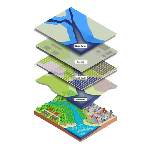

Change Detection
Slope aspect analysis
Land cover classification
Coastal ecosystem management
Forestry mapping
Agricultural mapping
Change Detection
Change Detection
Change detection in GIS remote sensing services involves comparing aerial photographs or satellite imagery of the area
Slope aspect analysis

Slope aspect analysis
Our GIS remote sensing company provides slope aspect analysis. Slope is the steepness of the incline of a surface and aspect is the orientation of slope.
Land cover classification
Land cover classification
For the planning and development of the land parcel, land use and land cover can be studied with GIS remote sensing. It is also carried out to study the land utilization
Coastal ecosystem management

Coastal ecosystem management
For coastal data definition, collection, and storage, the GIS encourages the development and use of standards. Before a proposed strategy is imposed on the real-world system, GIS offers the ability to model, test and compare alternative management scenarios.
Forestry mapping

Forestry mapping
To perform value assessments for certification, policy recommendations, funding, and regulatory compliances, the government and commercial agencies use Forestry GIS remote sensing services
Agricultural mapping
Agricultural mappingt
For monitoring and management of soil and irrigation of farmlands, our GIS remote sensing company is using agriculture mapping which is becoming crucial day by day.
Agriculture
By using NDVI slicing and spectral signatures collected during a GPS aided field survey, Hybrid classification techniques map a variety of crops. To support exporters, crop acreage and product estimates are done.

Communication Technology
Our GIS remote sensing company helps produce data for the telecom sector, so we deliver satellite images at various resolutions ranging from 0.61m to 250m

Banking & Insurance
We extend our services in the field of property and agriculture insurance. Our GIS remoting sensing company also offers health and stress monitoring of crops using multi-temporal satellite images
Forestry
Under green belt, we are providing services in mapping and change detection study of land cover. Knowledge classification techniques are used to carry out forest classification, species-level, and mapping of natural resources
